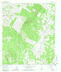
1964 Map of Delhi
USGS Topo · Published 1982About this map
The rural community of Delhi sits at the eastern edge of Caldwell County in this 1960s survey, updated with late 1970s aerial data. The landscape is defined by the headwaters of numerous streams, including Tenney Creek and Campbell Creek to the north, and the meandering course of the Sandy Fork through the center. Small-scale development is sparse, centered primarily around the Delhi Ch and a nearby Landing Strip, reflecting the area's enduring agricultural character.
Find a feature on this map
14 named features on this map. Tap any name to fly to it.
Don’t see what you’re looking for? This feature index may not catch every label — zoom into the map to look around manually.
Map Details
Editions of this 1964 Delhi Map
2 editions found
Other maps of this area

1901 · Flatonia
USGS Topo · 1:125,000

1911 · San Marcos
USGS Topo · 1:125,000

1919 · San Marcos
USGS Topo · 1:125,000

1925 · San Marcos 1-d
USGS Topo · 1:48,000

1925 · San Marcos 4-a
USGS Topo · 1:48,000

1929 · Luling
USGS Topo · 1:62,500

1930 · Lockhart
USGS Topo · 1:62,500

1953 · Seguin
USGS Topo · 1:250,000

1958 · Seguin
USGS Topo · 1:250,000
1963 · McMahan
USGS Topo · 1:24,000