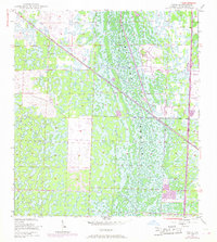
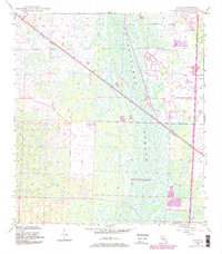
1945 Map of Delta
USGS Topo · Published 1968About this map
Loxahatchee Slough dominates this 1945 landscape, captured during a period of significant infrastructure development in Palm Beach County. The vast wetland network is bisected by the Seaboard Air Line railroad, which runs diagonally through the terrain. The small settlement of Delta is positioned along this rail corridor, serving as a lonely outpost in the marshy interior.
Find a feature on this map
9 named features on this map. Tap any name to fly to it.
Don’t see what you’re looking for? This feature index may not catch every label — zoom into the map to look around manually.
Map Details
Editions of this 1945 Delta Map
6 editions found
Other maps of this area

1945 · Delta
USGS Topo · 1:24,000

1946 · Riviera Beach
USGS Topo · 1:24,000

1946 · Palm Beach Farms
USGS Topo · 1:24,000

1946 · Palm Beach
USGS Topo · 1:24,000

1948 · Rood
USGS Topo · 1:24,000

1948 · Jupiter
USGS Topo · 1:24,000

1949 · Rood
USGS Topo · 1:24,000

1949 · Palm Beach Farms
USGS Topo · 1:24,000

1949 · Riviera Beach
USGS Topo · 1:24,000

1950 · Jupiter
USGS Topo · 1:24,000