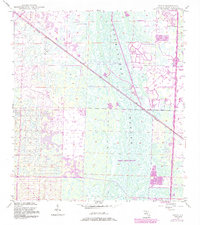
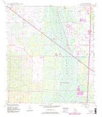
1945 Map of Delta
USGS Topo · Published 1983About this map
Loxahatchee Slough dominates the central landscape of this Palm Beach County region, reflecting the intricate wetland patterns of South Florida before more intensive suburban development. The 1945 planetable surveys capture the early footprint of Delta, a small settlement positioned along the diagonal route of the Seaboard railroad. By the early 1980s, photogrammetric revisions introduce the burgeoning infrastructure of Palm Beach Gardens, including sprawling residential tracts and a prominent Golf Course. The map highlights a significant transition in transportation as the traditional rail line is joined by modern high-speed corridors like Floridas Turnpike (Toll Road). Researchers can trace the arrival of modern convenience via Interchange 44 and its associated Tollgate, which stand in contrast to the earlier Landing Strip and the vast undeveloped expanses of the slough that characterize the area's original wilderness state.
Find a feature on this map
13 named features on this map. Tap any name to fly to it.
Don’t see what you’re looking for? This feature index may not catch every label — zoom into the map to look around manually.
Map Details
Editions of this 1945 Delta Map
6 editions found
Other maps of this area

1945 · Delta
USGS Topo · 1:24,000

1946 · Riviera Beach
USGS Topo · 1:24,000

1946 · Palm Beach Farms
USGS Topo · 1:24,000

1946 · Palm Beach
USGS Topo · 1:24,000

1948 · Rood
USGS Topo · 1:24,000

1948 · Jupiter
USGS Topo · 1:24,000

1949 · Rood
USGS Topo · 1:24,000

1949 · Palm Beach Farms
USGS Topo · 1:24,000

1949 · Riviera Beach
USGS Topo · 1:24,000

1950 · Jupiter
USGS Topo · 1:24,000