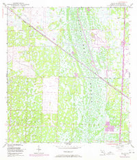
1945 Map of Delta
USGS Topo · Published 1974About this map
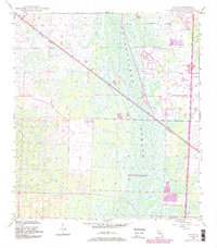
The Loxahatchee Slough dominates this landscape in northern Palm Beach County, appearing here as a complex network of wetlands and cypress strands just before modern drainage and suburban expansion transformed the region. The Seaboard Coast Line railroad cuts a sharp diagonal through the marsh, passing through the small outpost of Delta, which served as a critical transit point in an otherwise difficult terrain. While much of the area remained undeveloped during the mid-1940s survey, 1970s photorevisions reveal the early encroachment of recreation and infrastructure, including a Golf Course and a Landing Strip. These additions signal the transition from a wilderness-dominated interior to a managed landscape, while interior access remained limited to a single Jeep Trail winding through the southern reaches of the slough.
Find a feature on this map
8 named features on this map. Tap any name to fly to it.
Don’t see what you’re looking for? This feature index may not catch every label — zoom into the map to look around manually.
Map Details
Editions of this 1945 Delta Map
6 editions found
Other maps of this area

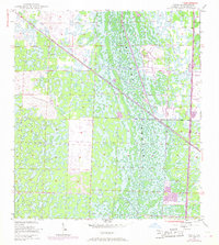
1945 · Delta
USGS Topo · 1:24,000

1946 · Riviera Beach
USGS Topo · 1:24,000

1946 · Palm Beach Farms
USGS Topo · 1:24,000

1946 · Palm Beach
USGS Topo · 1:24,000

1948 · Rood
USGS Topo · 1:24,000

1948 · Jupiter
USGS Topo · 1:24,000

1949 · Rood
USGS Topo · 1:24,000

1949 · Palm Beach Farms
USGS Topo · 1:24,000

1949 · Riviera Beach
USGS Topo · 1:24,000

1950 · Jupiter
USGS Topo · 1:24,000