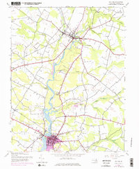
1944 Map of Denton
USGS Topo · Published 1976About this map
The Choptank River serves as the central artery for this part of Caroline County, winding through the landscape between the primary hubs of Greensboro and Denton. This mid-century survey, updated in the 1970s, captures a transition from traditional river-and-rail commerce toward highway-driven growth. Several landings along the riverbank, including Brick Wall Landing, Passapae Landing, and Smith Landing, indicate the enduring importance of the waterway for local transport and industry.
Find a feature on this map
37 named features on this map. Tap any name to fly to it.
Don’t see what you’re looking for? This feature index may not catch every label — zoom into the map to look around manually.
Map Details
Editions of this 1944 Denton Map
5 editions found
Other maps of this area

1899 · Dover
USGS Topo · 1:125,000

1905 · Denton
USGS Topo · 1:62,500

1905 · Barclay
USGS Topo · 1:62,500

1906 · Dover
USGS Topo · 1:125,000

1918 · Harrington
USGS Topo · 1:62,500

1920 · Dover
USGS Topo · 1:125,000

1926 · Wyoming
USGS Topo · 1:48,000

1930 · Wyoming
USGS Topo · 1:62,500

1931 · Wyoming
USGS Topo · 1:62,500

1944 · Denton
USGS Topo · 1:31,680