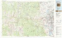
1983 Map of Denver West
USGS Topo · Published 1983About this map
Mount Evans and the soaring peaks of the Front Range dominate the western half of this 1983 survey, while the eastern edge documents the rapid suburban expansion of the Denver metropolitan area. The transition from the high-altitude wilderness of the Roosevelt National Forest and Arapaho National Forest to the industrial and residential corridors of Arvada, Lakewood, and Westminster is sharply defined by the Dakota Hogback. This map records critical infrastructure of the early 1980s, including the Rocky Flats Plant and the sprawling Federal Center. Along the mountain corridors, historical mining towns like Idaho Springs and Silver Plume are shown situated along the I-70 and Us-6 routes, while the Moffat Tunnel and Denver and Rio Grande Western railroad indicate the vital transportation arteries through the continental divide.
Find a feature on this map
218 named features on this map. Tap any name to fly to it.
Don’t see what you’re looking for? This feature index may not catch every label — zoom into the map to look around manually.
Map Details
Editions of this 1983 Denver West Map
2 editions found
Other maps of this area

1889 · Leadville
USGS Topo · 1:125,000

1890 · East Denver
USGS Topo · 1:125,000

1891 · Leadville
USGS Topo · 1:125,000

1893 · Platte Canyon
USGS Topo · 1:125,000

1894 · Castle Rock
USGS Topo · 1:125,000

1899 · West Denver
USGS Topo · 1:125,000

1902 · Greeley
USGS Topo · 1:125,000

1902 · Boulder
USGS Topo · 1:62,500

1903 · Georgetown
USGS Topo · 1:62,500

1904 · Niwot
USGS Topo · 1:62,500