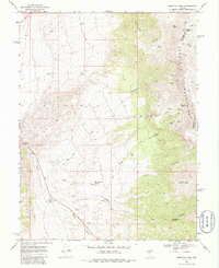
1969 Map of Desatoya Peak
USGS Topo · Published 1986About this map
The De Satoya Mountains dominate this high-desert landscape along the boundary of Churchill and Lander counties. Rising to the prominent summit of Desatoya Peak, the range is dissected by deep drainages including Rock Creek Canyon, Big Den Canyon, and Dry Canyon. This late 1960s survey captures the remote character of the region, where water sources like Rock Spring, Big Den Spring, and Park Canyon Spring serve as critical landmarks for navigation and land use. Settlement is sparse, anchored by the community of Eastgate in the western reaches of the quadrangle. The network of jeep trails and the presence of a Gravel Pit suggest a landscape primarily shaped by resource extraction and ranching. The topographical detail reveals a complex system of seasonal watercourses, such as Willow Creek and Buffalo Creek, which carve through the arid terrain below Bald Mountain.
Find a feature on this map
27 named features on this map. Tap any name to fly to it.
Don’t see what you’re looking for? This feature index may not catch every label — zoom into the map to look around manually.
Map Details
Editions of this 1969 Desatoya Peak Map
2 editions found
Other maps of this area

1955 · Millett
USGS Topo · 1:250,000

1956 · South Shoshone Peak
USGS Topo · 1:62,500

1959 · Millett
USGS Topo · 1:250,000

1969 · Camp Creek Canyon
USGS Topo · 1:24,000
1969 · Quartzite Mtn NW
USGS Topo · 1:24,000

1969 · Cold Springs
USGS Topo · 1:24,000

1969 · Desatoya Peak
USGS Topo · 1:24,000

1969 · Carroll Summit
USGS Topo · 1:24,000

1969 · Basque Summit
USGS Topo · 1:24,000

1969 · Eastgate
USGS Topo · 1:24,000