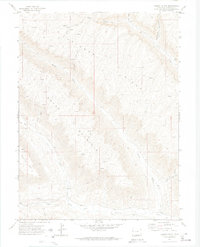
1971 Map of Desert Gulch
USGS Topo · Published 1974About this map
Skinner Ridge and Brush Mountain dominate this corner of Garfield County, where the landscape is defined by deep drainage basins and high dividing lines. The 1971 field survey reveals a terrain oriented around the natural flow of Roan Creek and Clear Creek, with the map showing how seasonal Springs and gulches like Cherry Gulch and Cottonwood Creek have carved the high country. Human movement through this environment is strictly tied to the topography, evidenced by the network of Pack Trails and Jeep Trails that skirt the ridges.
Find a feature on this map
23 named features on this map. Tap any name to fly to it.
Don’t see what you’re looking for? This feature index may not catch every label — zoom into the map to look around manually.
Map Details
Editions of this 1971 Desert Gulch Map
2 editions found
Other maps of this area

1929 · Highmore
USGS Topo · 1:62,500

1929 · Roan Creek
USGS Topo · 1:62,500

1956 · Grand Junction
USGS Topo · 1:250,000

1959 · Grand Junction
USGS Topo · 1:250,000

1960 · Grand Junction
USGS Topo · 1:250,000

1962 · Grand Junction
USGS Topo · 1:250,000

1964 · Grand Junction
USGS Topo · 1:250,000

1964 · Henderson Ridge
USGS Topo · 1:24,000
1964 · Razorback Ridge
USGS Topo · 1:24,000

1965 · Grand Junction
USGS Topo · 1:250,000