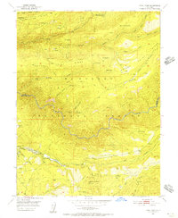
1950 Map of Devil Peak
USGS Topo · Published 1956About this map
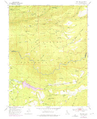
The Rubicon River carves a deep path through the heart of the Eldorado National Forest, shaping a landscape defined by steep drainages and industrial remnants. During the mid-twentieth century, this region of the Sierra Nevada was characterized by its extractive history, evidenced by numerous dormant workings such as the Pigeon Roost Mine and the Clydesdale Mine. A Dismantled Railroad follows the contours near Lookout Mountain, tracing the legacy of timber or mineral transport that once connected high-elevation outposts like Leonardi and Camp Ten to the broader valley. Local heritage is preserved in the names of family landmarks and remote habitations, including the Vaughn Cabin, Pilot Creek House, and the Bacchi Ranch near its namesake Reservoir. Higher elevations are marked by distinctive peaks such as Devil Peak and ridges like Nevada Point Ridge, which overlook the complex network of canyons including Big Grizzly Canyon and Wallace Canyon.
Find a feature on this map
54 named features on this map. Tap any name to fly to it.
Don’t see what you’re looking for? This feature index may not catch every label — zoom into the map to look around manually.
Map Details
Editions of this 1950 Devil Peak Map
7 editions found
Other maps of this area

1889 · Pyramid Peak
USGS Topo · 1:125,000

1891 · Colfax
USGS Topo · 1:125,000

1891 · Truckee
USGS Topo · 1:125,000

1891 · Placerville
USGS Topo · 1:125,000

1891 · Pyramid Peak
USGS Topo · 1:125,000

1892 · Placerville
USGS Topo · 1:125,000

1892 · Colfax
USGS Topo · 1:125,000

1893 · Placerville
USGS Topo · 1:125,000

1893 · Truckee
USGS Topo · 1:125,000

1894 · Colfax
USGS Topo · 1:125,000