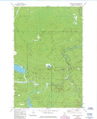
1955 Map of Dewey Lake NW
USGS Topo · Published 1985About this map
The Sturgeon River and Shannon River converge in this northern Minnesota landscape, where the waters of Shannon Lake and Perch Lake define the terrain. Much of the area is contained within the Superior National Forest, illustrating the managed wilderness of St. Louis County during the mid-twentieth century. The map shows the establishment of Mc Carthy Beach State Park along the southern lakeshore, a key recreational destination. Industrial and logistical activity is noted by a Gravel Pit near Jean Lake and a Heliport to the north. Smaller water bodies like Luna Lake and Louise Lake are scattered through the wooded townships of Morcom, Sturgeon, and French Township, while a Gaging Station on the river indicates the ongoing hydrologic monitoring by the Minnesota Department of Conservation.
Find a feature on this map
21 named features on this map. Tap any name to fly to it.
Don’t see what you’re looking for? This feature index may not catch every label — zoom into the map to look around manually.
Map Details
Editions of this 1955 Dewey Lake NW Map
3 editions found
Other maps of this area

1954 · Hibbing
USGS Topo · 1:250,000

1955 · Dark Lake
USGS Topo · 1:24,000

1955 · Dewey Lake SE
USGS Topo · 1:24,000

1955 · Dewey Lake NW
USGS Topo · 1:24,000

1955 · Dewey Lake
USGS Topo · 1:24,000

1957 · Hibbing
USGS Topo · 1:250,000

1958 · Hibbing
USGS Topo · 1:250,000

1964 · Hibbing
USGS Topo · 1:250,000

1964 · Side Lake
USGS Topo · 1:24,000

1964 · Linden Grove
USGS Topo · 1:24,000