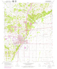
1963 Map of Dexter
USGS Topo · Published 1979About this map
Dexter serves as the focal point for this survey, situated at a major rail intersection where the Missouri Pacific and St Louis Southwestern lines meet. The 1970s revisions, highlighted in purple, show the town’s growth toward the Dexter Municipal Airport and along major thoroughfares. Local infrastructure is well-defined, including the Stoddard PO, City Hall, and several educational facilities such as Central Sch and Southwest Sch.
Find a feature on this map
41 named features on this map. Tap any name to fly to it.
Don’t see what you’re looking for? This feature index may not catch every label — zoom into the map to look around manually.
Map Details
Editions of this 1963 Dexter Map
3 editions found
Other maps of this area

1934 · Bloomfield
USGS Topo · 1:62,500

1934 · Puxico
USGS Topo · 1:62,500

1939 · Bloomfield
USGS Topo · 1:62,500

1939 · Puxico
USGS Topo · 1:62,500

1940 · Malden
USGS Topo · 1:62,500

1940 · Valley Ridge
USGS Topo · 1:62,500

1949 · Bloomfield
USGS Topo · 1:62,500

1956 · Valley Ridge
USGS Topo · 1:62,500

1956 · Malden
USGS Topo · 1:62,500

1956 · Dyersburg
USGS Topo · 1:250,000