
1983 Map of Dill City
USGS Topo · Published 1984About this map
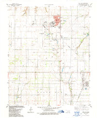
Burns Flat and Dill City anchor this Washita County landscape during the early 1980s, a period characterized by a mix of aviation infrastructure and rural agricultural life. The sprawling Clinton-Sherman Airport dominates the northern section, including an adjacent U S Military Reservation and a dedicated Industrial Park. This concentration of infrastructure in the north contrasts with the southern half of the quadrangle, where the Atchison Topeka and Sante Fe railroad line cuts through the countryside toward Dill City. Local history is preserved in a series of family and community cemeteries, such as Novis Cem, Boggy Cem, and both North Burns Cem and South Burns Cem. Educational and recreational hubs like the Western Oklahoma Vo-Tech Sch and Adams Lake City Park reflect the community development in this part of Oklahoma.
Find a feature on this map
44 named features on this map. Tap any name to fly to it.
Don’t see what you’re looking for? This feature index may not catch every label — zoom into the map to look around manually.
Map Details
Editions of this 1983 Dill City Map
2 editions found
Other maps of this area

1955 · Clinton
USGS Topo · 1:250,000

1957 · Clinton
USGS Topo · 1:250,000

1957 · Dill City
USGS Topo · 1:62,500

1961 · Hobart
USGS Topo · 1:62,500

1961 · Retrop
USGS Topo · 1:62,500

1961 · Elk City
USGS Topo · 1:62,500

1976 · Dill City NE
USGS Topo · 1:24,000

1976 · Dill City SE
USGS Topo · 1:24,000
1983 · Foss
USGS Topo · 1:24,000
1983 · Dill City SE
USGS Topo · 1:24,000