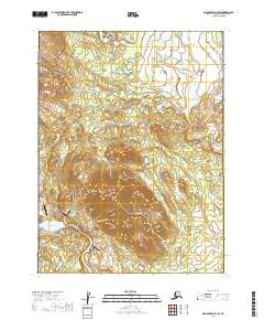
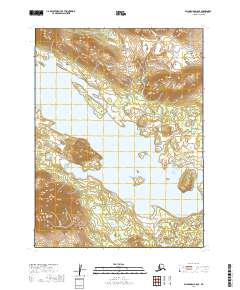
2019 Map of Dillingham B-7 SW
USGS Topo · Published 2019About this map
Aleknagik sits along the southeastern shores of Lake Aleknagik in this 2019 survey, representing a vital hub for transportation and community life in the Bristol Bay region. The map details the local infrastructure supporting this settlement, including the Aleknagik Mission Strip and the Aleknagik /New Airport. Further inland, the landscape rises toward the Wood River Mountains and the prominent peak of Marsh Mtn, which is accessed via the Marsh Mountain Road. The drainage patterns are defined by the Muklung River and the Wood River, which provide essential water routes. A network of local roads such as Suravak Road and Muklung Road connect the residential areas and nearby facilities like Tripod Airport, illustrating the modern balance of air and road travel in rural Alaska.
Find a feature on this map
28 named features on this map. Tap any name to fly to it.
Don’t see what you’re looking for? This feature index may not catch every label — zoom into the map to look around manually.
Map Details
Editions of this 2019 Dillingham B-7 SW Map
This is the sole edition of this map. No revisions or reprints were ever made.
Other maps of this area

1951 · Dillingham
USGS Topo · 1:250,000

1952 · Dillingham A-8
USGS Topo · 1:63,360

1952 · Dillingham A-7
USGS Topo · 1:63,360

1954 · Dillingham
USGS Topo · 1:250,000

1954 · Dillingham B-7
USGS Topo · 1:63,360

1954 · Dillingham B-8
USGS Topo · 1:63,360
2019 · Dillingham A-7 NE
USGS Topo · 1:25,000
2019 · Dillingham A-8 NE
USGS Topo · 1:25,000
2019 · Dillingham B-7 NE
USGS Topo · 1:25,000
2019 · Dillingham B-8 SE
USGS Topo · 1:25,000