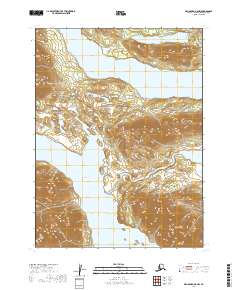
2019 Map of Dillingham B-8 NW
USGS Topo · Published 2019About this map
Lake Nerka and Lake Aleknagik dominate this 2019 survey of the Dillingham region, connected by the south-flowing Agulowak River. The landscape is defined by its massive freshwater systems and the rising elevations that frame them. In the northern portion, the waters of Lynx Lake sit near the base of Bunyok Ridge, while further south, the terrain climbs sharply toward the summits of Nunvuk Mtn and Jackknife Mtn. This map documents a largely undeveloped wilderness within the Wood-Tikchik State Park area, showing the natural drainage patterns where Fenno Cr feeds into the larger lake systems. The lack of roads or permanent settlements on this sheet highlights the isolation of this interior Alaskan terrain, where travel is dictated by the waterways and the steep ridgelines that divide them.
Find a feature on this map
12 named features on this map. Tap any name to fly to it.
Don’t see what you’re looking for? This feature index may not catch every label — zoom into the map to look around manually.
Map Details
Editions of this 2019 Dillingham B-8 NW Map
This is the sole edition of this map. No revisions or reprints were ever made.
Other maps of this area

1951 · Dillingham
USGS Topo · 1:250,000

1951 · Goodnews
USGS Topo · 1:250,000

1954 · Dillingham
USGS Topo · 1:250,000

1954 · Dillingham B-8
USGS Topo · 1:63,360

1954 · Dillingham C-8
USGS Topo · 1:63,360

1979 · Goodnews Bay B-1
USGS Topo · 1:63,360

1979 · Goodnews Bay
USGS Topo · 1:250,000

1979 · Goodnews Bay C-1
USGS Topo · 1:63,360
2019 · Dillingham B-8 SE
USGS Topo · 1:25,000
2019 · Dillingham C-8 SW
USGS Topo · 1:25,000