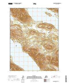
2019 Map of Dillingham B-8 SW
USGS Topo · Published 2019About this map
Lake Aleknagik and Lake Nunavaugaluk dominate the northern and southern margins of this interior landscape, which is defined by the high terrain separating these two significant water bodies. Situated northwest of Dillingham, this region is a complex system of drainage and relief where small waterways like Ice Cr and Bear Cr carve through the coastal mountains. The U.S. Geological Survey topography reveals the intricate contouring of the ridges that form the watershed between the Wood River and Nushagak River systems. This 2019 survey documents the Public Land Survey System grid across Townships 9S through 11S, providing a precise spatial record of this undeveloped stretch of the Alaska Dillingham Census Area.
Find a feature on this map
10 named features on this map. Tap any name to fly to it.
Don’t see what you’re looking for? This feature index may not catch every label — zoom into the map to look around manually.
Map Details
Editions of this 2019 Dillingham B-8 SW Map
This is the sole edition of this map. No revisions or reprints were ever made.
Other maps of this area

1951 · Dillingham
USGS Topo · 1:250,000

1951 · Goodnews
USGS Topo · 1:250,000

1952 · Dillingham A-8
USGS Topo · 1:63,360

1954 · Dillingham
USGS Topo · 1:250,000

1954 · Dillingham B-8
USGS Topo · 1:63,360
1979 · Goodnews Bay A-1
USGS Topo · 1:63,360

1979 · Goodnews Bay B-1
USGS Topo · 1:63,360

1979 · Goodnews Bay
USGS Topo · 1:250,000
2019 · Dillingham A-8 NE
USGS Topo · 1:25,000
2019 · Dillingham B-8 SE
USGS Topo · 1:25,000