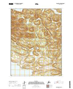
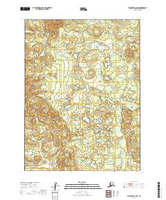
2019 Map of Dillingham C-7 NW
USGS Topo · Published 2019About this map
Lake Kulik and Lake Beverley anchor the northern and southern reaches of this landscape, reflecting the glacial geography of the Dillingham region. The map reveals an intricate drainage network where Moose Cr winds through the central terrain, joined by the smaller flows of Hope Cr and Spider Cr. This 2019 survey documents the area's hydrography and elevation contours with modern precision, emphasizing the undeveloped character of the Alaskan interior within the survey boundaries of T5S R55W and T6S R54W. The lack of roads or permanent structures highlighted in this data underscores the remote, waterway-dependent nature of the local environment.
Find a feature on this map
9 named features on this map. Tap any name to fly to it.
Don’t see what you’re looking for? This feature index may not catch every label — zoom into the map to look around manually.
Map Details
Editions of this 2019 Dillingham C-7 NW Map
This is the sole edition of this map. No revisions or reprints were ever made.
Other maps of this area

1951 · Dillingham
USGS Topo · 1:250,000

1954 · Dillingham
USGS Topo · 1:250,000

1954 · Dillingham D-7
USGS Topo · 1:63,360

1954 · Dillingham D-8
USGS Topo · 1:63,360

1954 · Dillingham C-7
USGS Topo · 1:63,360

1954 · Dillingham C-8
USGS Topo · 1:63,360
2019 · Dillingham C-7 SE
USGS Topo · 1:25,000
2019 · Dillingham C-8 SE
USGS Topo · 1:25,000
2019 · Dillingham C-7 SW
USGS Topo · 1:25,000
2019 · Dillingham C-7 NE
USGS Topo · 1:25,000