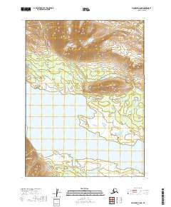
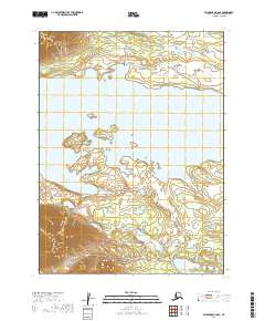
2019 Map of Dillingham C-8 NE
USGS Topo · Published 2019About this map
Lake Beverley dominates the southern landscape of this 2019 survey, illustrating the complex shoreline of southwestern Alaska's interior. This glacial-fed system includes the sheltered waters of Hardluck Bay, where the transition from deep water to intricate wetlands reflects the dynamic hydrology of the Dillingham region. To the north, the terrain rises into high ridges cut by drainage systems like Unuohkuik Cr and Hope Cr. These watercourses reveal the natural drainage patterns of the Wood-Tikchik area, illustrating how seasonal runoff from the surrounding peaks feeds the larger lake basins below. The map provides a clear look at the township and range divisions across T5S and T6S, showing the systematic surveying of this largely undeveloped territory.
Find a feature on this map
8 named features on this map. Tap any name to fly to it.
Don’t see what you’re looking for? This feature index may not catch every label — zoom into the map to look around manually.
Map Details
Editions of this 2019 Dillingham C-8 NE Map
This is the sole edition of this map. No revisions or reprints were ever made.
Other maps of this area

1951 · Dillingham
USGS Topo · 1:250,000

1954 · Dillingham
USGS Topo · 1:250,000

1954 · Dillingham D-7
USGS Topo · 1:63,360

1954 · Dillingham D-8
USGS Topo · 1:63,360

1954 · Dillingham C-7
USGS Topo · 1:63,360

1954 · Dillingham C-8
USGS Topo · 1:63,360
2019 · Dillingham C-8 NW
USGS Topo · 1:25,000
2019 · Dillingham D-8 SW
USGS Topo · 1:25,000
2019 · Dillingham C-8 SW
USGS Topo · 1:25,000
2019 · Dillingham C-8 SE
USGS Topo · 1:25,000