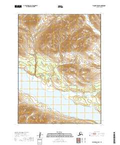
2019 Map of Dillingham D-8 SE
USGS Topo · Published 2019About this map
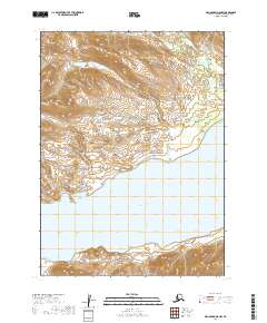
Lake Kulik dominates the southern landscape of this remote subarctic region, serving as a primary hydrologic anchor for the surrounding watershed. The terrain is defined by the winding course of the Grant River, which meanders through the central and southern sections before meeting the lake's northern shore. This 2019 survey documents a largely undeveloped wilderness within the Dillingham Census Area, characterized by high-relief topography and glacial valley systems. In the southwestern corner, the drainage of Younhukkuk Cr carves through the steep elevation, illustrating the transition from upland ridges to the lake basin. The map provides a clear record of township and range boundaries, including t3s r55w and t5s r55w, which grid this otherwise trackless territory. The absence of roads or permanent settlements underscores the isolation of this interior Alaskan environment.
Find a feature on this map
9 named features on this map. Tap any name to fly to it.
Don’t see what you’re looking for? This feature index may not catch every label — zoom into the map to look around manually.
Map Details
Editions of this 2019 Dillingham D-8 SE Map
This is the sole edition of this map. No revisions or reprints were ever made.
Other maps of this area

1951 · Dillingham
USGS Topo · 1:250,000

1954 · Dillingham
USGS Topo · 1:250,000

1954 · Dillingham D-7
USGS Topo · 1:63,360

1954 · Dillingham D-8
USGS Topo · 1:63,360

1954 · Dillingham C-7
USGS Topo · 1:63,360

1954 · Dillingham C-8
USGS Topo · 1:63,360
2019 · Dillingham C-8 NW
USGS Topo · 1:25,000
2019 · Dillingham D-7 NW
USGS Topo · 1:25,000
2019 · Dillingham D-8 SW
USGS Topo · 1:25,000
2019 · Dillingham D-8 NW
USGS Topo · 1:25,000