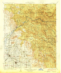
1924 Map of Dinuba
USGS Topo · Published 1924About this map
The Kings River serves as the central artery for this 1924 landscape, marking the transition from the irrigated orchards of the Central Valley into the foothills of the Sierra National Forest and Sequoia National Forest. The map documents a sophisticated agricultural infrastructure, defined by the Alta Main Canal and Enterprise Canal, which transformed the arid valley floor into a productive hub. This development is anchored by the Wahtoke Winery and central shipping points like Reedley and Dinuba, where the Southern Pacific and Santa Fe and Atchison Topeka and Santa Fe railroads facilitated the movement of regional goods.
Find a feature on this map
139 named features on this map. Tap any name to fly to it.
Don’t see what you’re looking for? This feature index may not catch every label — zoom into the map to look around manually.
Map Details
Editions of this 1924 Dinuba Map
5 editions found

Other maps of this area

1903 · Tehipite
USGS Topo · 1:125,000

1904 · Kaiser
USGS Topo · 1:125,000

1904 · Kaweah
USGS Topo · 1:125,000

1905 · Tehipite
USGS Topo · 1:125,000

1909 · Kaweah
USGS Topo · 1:125,000

1912 · Mariposa
USGS Topo · 1:125,000

1912 · Mt. Goddard
USGS Topo · 1:125,000

1920 · Orangedale School
USGS Topo · 1:24,000

1921 · Squaw Valley
USGS Topo · 1:31,680

1921 · Stokes Mountain
USGS Topo · 1:24,000