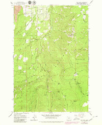
1962 Map of Dog River
USGS Topo · Published 1980About this map
The Upper Hood River Valley and its surrounding forest lands are documented here just as modern recreation and water management infrastructure were firmly established. The map reveals a landscape defined by its drainages, where the Dog River and its East Fork serve as primary arteries for the region. A notable industrial presence is marked by The Dalles City Waterworks Gaging Station, indicating the critical role of these highlands in regional water supply.
Find a feature on this map
73 named features on this map. Tap any name to fly to it.
Don’t see what you’re looking for? This feature index may not catch every label — zoom into the map to look around manually.
Map Details
Editions of this 1962 Dog River Map
4 editions found
Other maps of this area

1924 · Mount Hood
USGS Topo · 1:125,000

1926 · Hood River
USGS Topo · 1:125,000

1927 · Mount Hood
USGS Topo · 1:125,000

1929 · Hood River
USGS Topo · 1:125,000

1930 · Dufur
USGS Topo · 1:125,000

1934 · Dufur
USGS Topo · 1:125,000

1934 · The Dalles
USGS Topo · 1:125,000

1953 · The Dalles
USGS Topo · 1:250,000

1956 · The Dalles
USGS Topo · 1:250,000

1957 · The Dalles
USGS Topo · 1:250,000