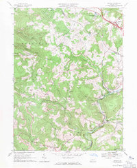
1967 Map of Donegal
USGS Topo · Published 1971About this map
Chestnut Ridge dominates the center of this 1967 survey, where the border between Westmoreland and Fayette counties follows the high ground. The landscape is characterized by narrow valleys and industrial activity, notably the numerous strip mines that mark the slopes above Newmyer Run and Champion Creek. The eastern edge of the map shows a concentrated corridor of commerce and transport where the Pennsylvania Turnpike meets Interchange 9 near the borough of Donegal.
Find a feature on this map
52 named features on this map. Tap any name to fly to it.
Don’t see what you’re looking for? This feature index may not catch every label — zoom into the map to look around manually.
Map Details
Editions of this 1967 Donegal Map
4 editions found
Other maps of this area

1900 · Uniontown
USGS Topo · 1:62,500

1902 · Connellsville
USGS Topo · 1:62,500

1922 · Confluence
USGS Topo · 1:62,500

1922 · Donegal
USGS Topo · 1:62,500

1931 · Connellsville
USGS Topo · 1:62,500

1931 · Uniontown
USGS Topo · 1:62,500

1931 · Confluence
USGS Topo · 1:62,500

1933 · Confluence
USGS Topo · 1:62,500

1935 · Donegal
USGS Topo · 1:62,500

1936 · Connellsville
USGS Topo · 1:62,500
Featured Places
- Donegal, PA
- Bullskin Township, PA
- Springfield Township, PA
- Saltlick Township, PA
- Mount Pleasant Township, PA