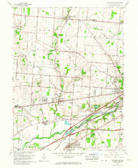
1965 Map of Donnelsville
USGS Topo · Published 1967About this map
Donnelsville and Enon anchor this mid-1960s landscape, where the rural character of western Clark County is defined by a dense network of pikes and river-bottom railroads. The Mad River flows through the southern portion of the quadrangle, paralleled by the Erie Lackawanna and New York Central rail lines. This corridor is punctuated by smaller industrial and transit stops like Cold Springs Station and Snyderville.
Find a feature on this map
63 named features on this map. Tap any name to fly to it.
Don’t see what you’re looking for? This feature index may not catch every label — zoom into the map to look around manually.
Map Details
Editions of this 1965 Donnelsville Map
3 editions found
Other maps of this area

1904 · Springfield
USGS Topo · 1:62,500

1904 · Dayton
USGS Topo · 1:62,500

1906 · Dayton
USGS Topo · 1:62,500

1906 · Springfield
USGS Topo · 1:62,500

1914 · Troy
USGS Topo · 1:62,500

1914 · St. Paris
USGS Topo · 1:62,500

1916 · St. Paris
USGS Topo · 1:62,500

1944 · St. Paris
USGS Topo · 1:62,500

1944 · Troy
USGS Topo · 1:62,500

1947 · Columbus
USGS Topo · 1:250,000