Loading...
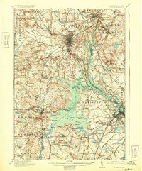
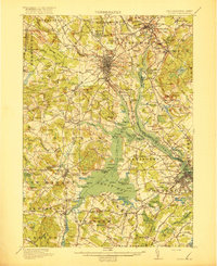
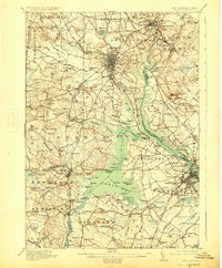
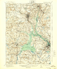
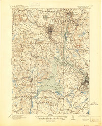
Loading map...1918 Map of Dover
USGS Topo · Published 1931About this map
Piscataqua River and its sprawling tidal tributaries, including Little Bay and Great Bay, dominate this coastal landscape at the New Hampshire-Maine border. As mapped during the early 20th century, the region's economy and social structure are clearly visible through the density of district schools and the complex network of the Boston and Maine Railroad. Significant educational hubs like the State College in Durham stand alongside numerous rural schoolhouses such as Madbury School and Winniconic School.
Find a feature on this map
59 named features on this map. Tap any name to fly to it.
Don’t see what you’re looking for? This feature index may not catch every label — zoom into the map to look around manually.
Map Details
Date Portrayed1918
Date Published1931
PublisherU.S. Geological Survey
Map TypeTopographic
Scale1:62,500
Physical Dimensions16.5 x 19.8 inches
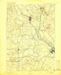
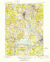
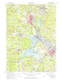
Editions of this 1918 Dover Map
6 editions found

Historical Maps of Dover Through Time
5 maps found

Featured Locations
Source Details
SourceU.S. Geological Survey
CopyrightPublic Domain