Loading...
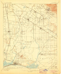
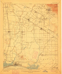
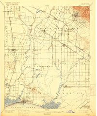
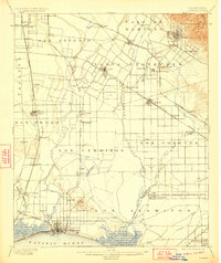
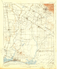
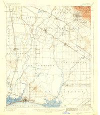
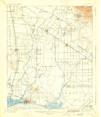
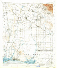
Loading map...1902 Map of Downey
USGS Topo · Published 1906About this map
The San Gabriel River and Los Angeles River dominate this early twentieth-century landscape, carving through a region defined by Mexican land grant lineages like Los Cerritos and Los Coyotes. Before the suburban sprawl of the mid-century, this area was a network of rail-side settlements and agricultural hubs. Notable clusters include the development at Downey, the growing coastal presence of Long Beach, and the industrial foundations at Compton.
Find a feature on this map
77 named features on this map. Tap any name to fly to it.
Don’t see what you’re looking for? This feature index may not catch every label — zoom into the map to look around manually.
Map Details
Date Portrayed1902
Date Published1906
PublisherU.S. Geological Survey
Map TypeTopographic
Scale1:62,500
Physical Dimensions16.6 x 20 inches
Editions of this 1902 Downey Map
9 editions found

Historical Maps of Los Angeles Through Time
5 maps found


Featured Locations
Source Details
SourceU.S. Geological Survey
CopyrightPublic Domain