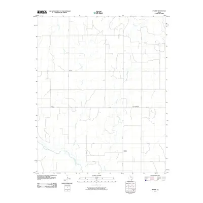
2010 Map of Dozier
USGS Topo · Published 2010About this map
Dozier and Samnorwood define the human landscape of this Collingsworth County region, where the Panhandle's agricultural grid meets the winding hydrology of the Salt Fork Red River. The area's settlement history is anchored by the Dozier Cemetery and Plymouth Cemetery, situated near the rural crossroads of the early 2000s. The landscape is characterized by numerous seasonal and perennial watercourses, including the central Dozier Creek and the eastern Lake Creek, which carve subtle drainage patterns through the terrain. A network of farm-to-market roads, such as FM 1547 and FM 1036, connects these isolated communities, illustrating the transportation infrastructure essential for Texas ranching and farming operations during this era.
Find a feature on this map
28 named features on this map. Tap any name to fly to it.
Don’t see what you’re looking for? This feature index may not catch every label — zoom into the map to look around manually.
Map Details
Editions of this 2010 Dozier Map
This is the sole edition of this map. No revisions or reprints were ever made.
Other maps of this area

1954 · Amarillo
USGS Topo · 1:250,000

1954 · Plainview
USGS Topo · 1:250,000

1958 · Amarillo
USGS Topo · 1:250,000

1958 · Plainview
USGS Topo · 1:250,000

1959 · Wellington NW
USGS Topo · 1:24,000

1963 · Ramsdell
USGS Topo · 1:24,000

1963 · Shamrock East
USGS Topo · 1:24,000

1963 · Shamrock West
USGS Topo · 1:24,000

1964 · Rolla NE
USGS Topo · 1:24,000

1964 · Quail
USGS Topo · 1:24,000