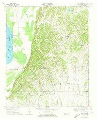
1970 Map of Drummonds
USGS Topo · Published 1973About this map
Drummonds serves as the focal point of this 1970s Tennessee landscape, where the loess bluffs of the Tipton County line overlook the broad alluvial plains of the Mississippi River. The settlement pattern follows the high ground along the ridge, marked by a dense network of country churches and schools such as Poplar Grove Ch and Drummonds Sch. To the west, the river environment is defined by dynamic shoreline features like Cedar Point and Sigler Island No 36, alongside oxbow remnants like Sullivan Lake and Round Pond. The map captures the agricultural and social centers of Quito and Dixonville before modern expansion, recording family-named infrastructure like Herring Road and Cole Road. This survey documents a critical transition where the plateau's drainage, including Sugar Creek and Royster Creek, meets the river's flood-prone bottomlands.
Find a feature on this map
43 named features on this map. Tap any name to fly to it.
Don’t see what you’re looking for? This feature index may not catch every label — zoom into the map to look around manually.
Map Details
Editions of this 1970 Drummonds Map
3 editions found
Other maps of this area

1931 · Jericho
USGS Topo · 1:62,500

1939 · Jericho
USGS Topo · 1:62,500

1939 · Evadale
USGS Topo · 1:62,500

1942 · Millington
USGS Topo · 1:62,500

1952 · Jericho
USGS Topo · 1:62,500

1953 · Memphis
USGS Topo · 1:250,000

1956 · Evadale
USGS Topo · 1:62,500

1956 · Memphis
USGS Topo · 1:250,000

1956 · Blytheville
USGS Topo · 1:250,000

1959 · Blytheville
USGS Topo · 1:250,000