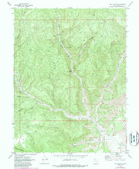
1970 Map of Dry Canyon
USGS Topo · Published 1987About this map
Westwater Creek and its many tributary canyons define this high-desert region of eastern Utah during the transition into the 1970s. The landscape is heavily marked by the infrastructure of the energy industry, with the Westwater Gas Field, Bryson Canyon Gas Field, and Pear Park Gas Field spanning the terrain. Numerous Gas Wells and Drill Holes are connected by a network of Jeep Trails, illustrating the mid-century push for resource extraction in Grand County.
Find a feature on this map
28 named features on this map. Tap any name to fly to it.
Don’t see what you’re looking for? This feature index may not catch every label — zoom into the map to look around manually.
Map Details
Editions of this 1970 Dry Canyon Map
2 editions found
Other maps of this area

1885 · East Tavaputs
USGS Topo · 1:250,000

1956 · Grand Junction
USGS Topo · 1:250,000

1959 · Grand Junction
USGS Topo · 1:250,000

1960 · Grand Junction
USGS Topo · 1:250,000

1962 · Grand Junction
USGS Topo · 1:250,000

1964 · Grand Junction
USGS Topo · 1:250,000

1965 · Grand Junction
USGS Topo · 1:250,000
1970 · Harley Dome
USGS Topo · 1:24,000

1970 · Flume Canyon
USGS Topo · 1:24,000
1970 · Cedar Camp Canyon
USGS Topo · 1:24,000