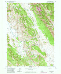
1949 Map of Dry Valley
USGS Topo · Published 1984About this map
High-altitude ranching and forest management define this 1949 survey of the Idaho high country. The landscape is dominated by the linear drainage of Dry Valley Creek, which provides a corridor for several established homesteads including the Stewart Ranch and Young Ranch. These family holdings are clustered where the valley floor meets the rising timber of the Caribou National Forest, illustrating the historical reliance on seasonal grazing and water access in the southeastern corner of the state.
Find a feature on this map
28 named features on this map. Tap any name to fly to it.
Don’t see what you’re looking for? This feature index may not catch every label — zoom into the map to look around manually.
Map Details
Editions of this 1949 Dry Valley Map
3 editions found
Other maps of this area

1911 · Slug Creek
USGS Topo · 1:62,500

1915 · Freedom
USGS Topo · 1:62,500

1915 · Crow Creek
USGS Topo · 1:62,500

1915 · Lanes Creek
USGS Topo · 1:62,500

1949 · Johnson Creek
USGS Topo · 1:24,000

1949 · Stewart Flat
USGS Topo · 1:24,000

1949 · Dry Valley
USGS Topo · 1:24,000

1949 · Snowdrift Mountain
USGS Topo · 1:24,000

1949 · Lower Valley
USGS Topo · 1:24,000

1951 · Lower Valley
USGS Topo · 1:24,000