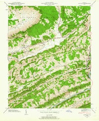
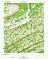
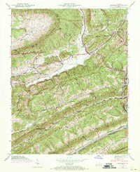
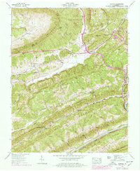
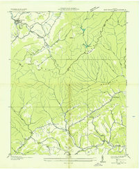
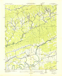
1947 Map of Duffield
USGS Topo · Published 1963About this map
Natural Tunnel and the surrounding karst topography of the Jefferson National Forest anchor this 1947 field examination of the Virginia high country. The map details a complex landscape where the Southern railroad maneuvers through the Bald Knob Tunnel and alongside the Clinch River. Settlement patterns follow the narrow valleys between Powell Mountain and Copper Ridge, with the Daniel Boone Trail passing through the village of Duffield. Notable for genealogists is the high density of family burial grounds, including the Willis Campbell Cem, Watson Cem, and Barnett Cem. The inclusion of the Hortons Summit (PO) and various small rural institutions like Purchase Sch and Mt View Ch provides a clear view of the social geography in the North Fork Valley before modern infrastructure changes.
Find a feature on this map
77 named features on this map. Tap any name to fly to it.
Don’t see what you’re looking for? This feature index may not catch every label — zoom into the map to look around manually.
Map Details
Editions of this 1947 Duffield Map
4 editions found
Other maps of this area

1894 · Estillville
USGS Topo · 1:125,000

1920 · Wise
USGS Topo · 1:48,000

1921 · Big Stone Gap
USGS Topo · 1:48,000

1921 · Wise
USGS Topo · 1:62,500

1922 · Big Stone Gap
USGS Topo · 1:62,500

1929 · Big Stone Gap
USGS Topo · 1:62,500

1935 · Moggasin
USGS Topo · 1:48,000

1935 · Looneys Gap
USGS Topo · 1:24,000
1935 · East Stone Gap
USGS Topo · 1:24,000
1935 · Keokee
USGS Topo · 1:24,000