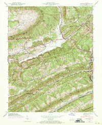
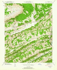
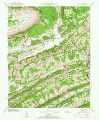
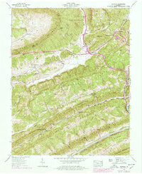
1947 Map of Duffield
USGS Topo · Published 1970About this map
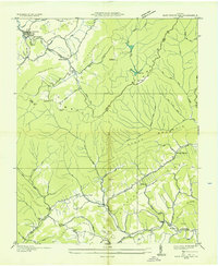
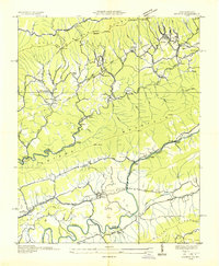
Natural Tunnel and the Southern railroad corridor anchor this 1947 study of the mountainous borderland between Lee and Scott counties. The landscape is defined by the massive parallel ridges of Powell Mountain and Copper Ridge, where the rail line traverses the Bald Knob Tunnel and passes through Copper Siding. Settlement patterns follow the narrow valley floors, connected by the historical Daniel Boone Trail which runs through Duffield and Pattonsville.
Find a feature on this map
92 named features on this map. Tap any name to fly to it.
Don’t see what you’re looking for? This feature index may not catch every label — zoom into the map to look around manually.
Map Details
Editions of this 1947 Duffield Map
4 editions found
Other maps of this area

1894 · Estillville
USGS Topo · 1:125,000

1920 · Wise
USGS Topo · 1:48,000

1921 · Big Stone Gap
USGS Topo · 1:48,000

1921 · Wise
USGS Topo · 1:62,500

1922 · Big Stone Gap
USGS Topo · 1:62,500

1929 · Big Stone Gap
USGS Topo · 1:62,500

1935 · Moggasin
USGS Topo · 1:48,000

1935 · Looneys Gap
USGS Topo · 1:24,000
1935 · East Stone Gap
USGS Topo · 1:24,000
1935 · Keokee
USGS Topo · 1:24,000