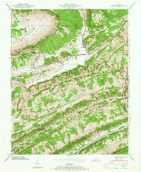
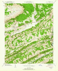
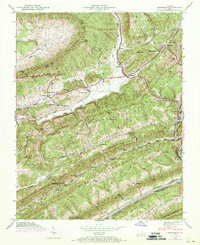
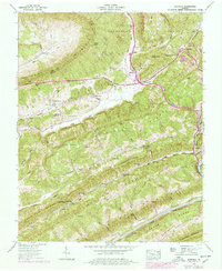
1947 Map of Duffield
USGS Topo · Published 1967About this map
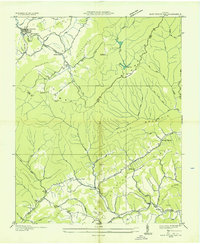
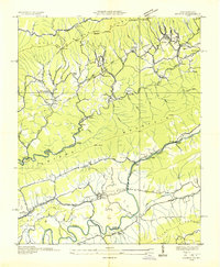
Powell Mountain and Jefferson National Forest dominate the northern landscape of this 1947 survey, where the Daniel Boone Boundary Trail winds through the high gaps. The terrain is defined by parallel ridges like Purchase Ridge and Copper Ridge, which channel the Clinch River and its tributaries. The Southern RR navigates this complex geography via the Bald Knob Tunnel and the famous Natural Tunnel, a massive limestone passage that serves as a focal point for the regional rail network.
Find a feature on this map
78 named features on this map. Tap any name to fly to it.
Don’t see what you’re looking for? This feature index may not catch every label — zoom into the map to look around manually.
Map Details
Editions of this 1947 Duffield Map
4 editions found
Other maps of this area

1894 · Estillville
USGS Topo · 1:125,000

1920 · Wise
USGS Topo · 1:48,000

1921 · Big Stone Gap
USGS Topo · 1:48,000

1921 · Wise
USGS Topo · 1:62,500

1922 · Big Stone Gap
USGS Topo · 1:62,500

1929 · Big Stone Gap
USGS Topo · 1:62,500

1935 · Moggasin
USGS Topo · 1:48,000

1935 · Looneys Gap
USGS Topo · 1:24,000
1935 · East Stone Gap
USGS Topo · 1:24,000
1935 · Keokee
USGS Topo · 1:24,000