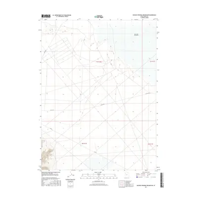
2017 Map of Dugway Proving Ground NW
USGS Topo · Published 2017About this map
The Great Salt Lake Desert dominates this landscape within the northwestern portion of the Dugway Proving Ground. This specific environment is characterized by an expansive, level terrain that transitions into the mud flats of the Great Salt Lake Basin. The map illustrates a strictly utilitarian road network designed for military or government access, including Goodyear Rd, Stark Rd, and Falconer Rd. These routes cut straight across the desert floor, following the grid system of the Public Land Survey System, as seen in the boundaries for t7s r12w and t8s r12w. The lack of traditional settlements or residential features underscores the restricted nature of the reservation during this period.
Find a feature on this map
8 named features on this map. Tap any name to fly to it.
Don’t see what you’re looking for? This feature index may not catch every label — zoom into the map to look around manually.
Map Details
Editions of this 2017 Dugway Proving Ground NW Map
This is the sole edition of this map. No revisions or reprints were ever made.
Other maps of this area

1953 · Tooele
USGS Topo · 1:250,000

1954 · Wig Mtn SW
USGS Topo · 1:24,000

1954 · Dugway Proving Ground SE
USGS Topo · 1:24,000

1954 · Dugway Proving Ground NE
USGS Topo · 1:24,000

1954 · Granite Peak
USGS Topo · 1:24,000

1954 · Dugway Proving Ground SW
USGS Topo · 1:24,000

1954 · Wildcat Mtn SE
USGS Topo · 1:24,000

1954 · Dugway Proving Ground NW
USGS Topo · 1:24,000

1954 · Granite Peak SE
USGS Topo · 1:24,000

1955 · Wig Mtn
USGS Topo · 1:24,000