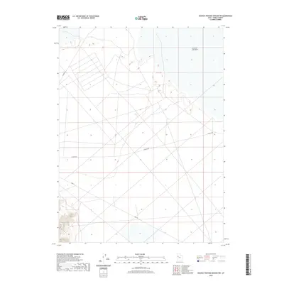
2020 Map of Dugway Proving Ground NW
USGS Topo · Published 2020About this map
Great Salt Lake Desert dominates this arid landscape in Tooele County, reflecting a vast expanse of salt flats and intermittent wetlands. The 2020 terrain is defined by a sparse network of roads, including Goodyear Rd, Stark Rd, and Falconer Rd, which crisscross the flat, white terrain. This area is characterized by its isolation and specialized use as part of a government reservation, where private access is strictly controlled. The map detail highlights the stark geometry of the desert basin, showing the subtle elevation changes across the playa. Researchers of military geography or Western Utah's unique physical environment will find the road network particularly informative, as these tracks represent the primary human imprint on this expansive, salt-crusted basin.
Find a feature on this map
4 named features on this map. Tap any name to fly to it.
Don’t see what you’re looking for? This feature index may not catch every label — zoom into the map to look around manually.
Map Details
Editions of this 2020 Dugway Proving Ground NW Map
This is the sole edition of this map. No revisions or reprints were ever made.
Other maps of this area

1953 · Tooele
USGS Topo · 1:250,000

1954 · Wig Mtn SW
USGS Topo · 1:24,000

1954 · Dugway Proving Ground SE
USGS Topo · 1:24,000

1954 · Dugway Proving Ground NE
USGS Topo · 1:24,000

1954 · Granite Peak
USGS Topo · 1:24,000

1954 · Dugway Proving Ground SW
USGS Topo · 1:24,000

1954 · Wildcat Mtn SE
USGS Topo · 1:24,000

1954 · Dugway Proving Ground NW
USGS Topo · 1:24,000

1954 · Granite Peak SE
USGS Topo · 1:24,000

1955 · Wig Mtn
USGS Topo · 1:24,000