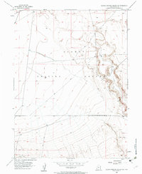
1954 Map of Dugway Proving Ground SE
USGS Topo · Published 1961About this map
Dugway Proving Ground dominates this 1954 topographic survey, revealing the remote desert landscape of Tooele, Utah, during a period of intense military activity. The map focuses on the arid basin characterized by the Old River Bed, a significant geological feature that snakes through the eastern portion of the quadrangle. The terrain is marked by intricate contour lines showing the gradual slopes and occasional steep escarpments typical of this part of the Great Salt Lake Desert.
Find a feature on this map
4 named features on this map. Tap any name to fly to it.
Don’t see what you’re looking for? This feature index may not catch every label — zoom into the map to look around manually.
Map Details
Editions of this 1954 Dugway Proving Ground SE Map
4 editions found
Other maps of this area

1885 · Sevier Desert
USGS Topo · 1:250,000

1885 · Tooele Valley
USGS Topo · 1:250,000

1908 · Fish Springs
USGS Topo · 1:250,000

1910 · Fish Springs
USGS Topo · 1:250,000

1953 · Dugway Range NE
USGS Topo · 1:24,000

1953 · Dugway Range
USGS Topo · 1:62,500

1953 · Dugway Range NW
USGS Topo · 1:24,000

1953 · Tooele
USGS Topo · 1:250,000

1953 · Delta
USGS Topo · 1:250,000

1954 · Dugway Proving Ground SE
USGS Topo · 1:24,000