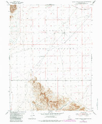
1954 Map of Dugway Proving Ground SW
USGS Topo · Published 1984About this map
The Dugway Proving Ground military reservation dominates this 1954 landscape, where the flat desert basin meets the steep relief of the Dugway Range. This map records a remote corner of Tooele County during the Cold War era, showing the transition from the broad, open basin to the mineral-rich slopes where a tunnel and shaft suggest historical prospecting activity in the southern heights. Transportation is defined by functional utility, ranging from the established Stark Road in the north to a rugged Jeep Trail winding through the southern foothills. Water management in this arid environment is highlighted by the presence of Government Well No 52 and the seasonal Dry Lake. The inclusion of Bullion Canyon points to the area's geological and perhaps mining history, while the sprawling military boundary underscores the mid-century expansion of government land use in the Utah desert.
Find a feature on this map
13 named features on this map. Tap any name to fly to it.
Don’t see what you’re looking for? This feature index may not catch every label — zoom into the map to look around manually.
Map Details
Editions of this 1954 Dugway Proving Ground SW Map
3 editions found

Other maps of this area

1908 · Fish Springs
USGS Topo · 1:250,000

1910 · Fish Springs
USGS Topo · 1:250,000

1953 · Dugway Range NE
USGS Topo · 1:24,000

1953 · Dugway Range
USGS Topo · 1:62,500

1953 · Dugway Range NW
USGS Topo · 1:24,000

1953 · Tooele
USGS Topo · 1:250,000

1953 · Delta
USGS Topo · 1:250,000

1954 · Dugway Proving Ground SE
USGS Topo · 1:24,000

1954 · Dugway Proving Ground NE
USGS Topo · 1:24,000

1954 · Granite Peak
USGS Topo · 1:24,000