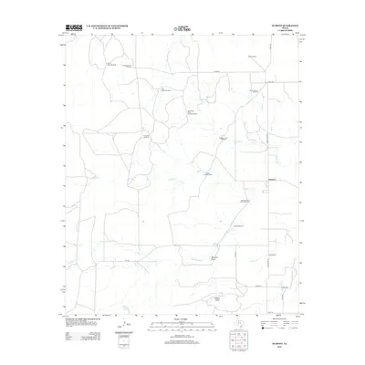
2012 Map of Dumont
USGS Topo · Published 2012About this map
The settlement of Dumont anchors this portion of King County, where the ranching economy is etched into the landscape through an extensive network of water infrastructure. Numerous named landmarks, such as Dumont Horse Pasture Windmill, Thief Hollow Windmill, and McDuff Windmill, illustrate the vital role of groundwater management in this arid region of West Texas. The drainage of the N Wichita River and its tributaries, including Middle Cr and Eighteen Cr, dictate the local topography, carving out features like Shinnery Draw and Wildcat Draw. Genealogists will find the Dumont Cem positioned along Farm Road 193, while the presence of Shinnery Springs suggests a historical reliance on natural water sources before the proliferation of the steel windmills seen today.
Find a feature on this map
31 named features on this map. Tap any name to fly to it.
Don’t see what you’re looking for? This feature index may not catch every label — zoom into the map to look around manually.
Map Details
Editions of this 2012 Dumont Map
This is the sole edition of this map. No revisions or reprints were ever made.
Other maps of this area

1954 · Lubbock
USGS Topo · 1:250,000

1967 · Guthrie NW
USGS Topo · 1:24,000

1968 · East Afton
USGS Topo · 1:24,000

1968 · Buffalo Creek
USGS Topo · 1:24,000

1968 · Russellville
USGS Topo · 1:24,000

1968 · Grow NW
USGS Topo · 1:24,000

1968 · Dumont
USGS Topo · 1:24,000

1968 · China Canyon
USGS Topo · 1:24,000

1968 · East Afton NE
USGS Topo · 1:24,000

1968 · Sanders Hollow
USGS Topo · 1:24,000