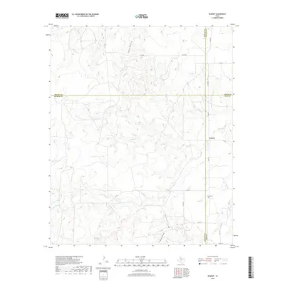
2019 Map of Dumont
USGS Topo · Published 2019About this map
Dumont sits at the eastern edge of this landscape, a high-plains community where the borders of Motley, Cottle, Dickens, and King counties converge. The terrain is defined by a complex drainage system flowing toward the N Wichita River, which snakes across the southern portion of the sheet. Numerous seasonal watercourses and topographic depressions like Thief Hollow, Middle Cr, and Eighteen Cr carve through the ranchland, illustrating the erosional patterns characteristic of the Rolling Plains. Local history and genealogy are centered around the Dumont Cem and the nearby Shinnery Springs, which likely served as vital water sources for early settlers and livestock in this semi-arid region. The road network, including FM 193 and FM 2569, connects the scattered farmsteads and rural routes that crisscross these wide-open county lines.
Find a feature on this map
24 named features on this map. Tap any name to fly to it.
Don’t see what you’re looking for? This feature index may not catch every label — zoom into the map to look around manually.
Map Details
Editions of this 2019 Dumont Map
This is the sole edition of this map. No revisions or reprints were ever made.
Other maps of this area

1954 · Lubbock
USGS Topo · 1:250,000

1967 · Guthrie NW
USGS Topo · 1:24,000

1968 · East Afton
USGS Topo · 1:24,000

1968 · Buffalo Creek
USGS Topo · 1:24,000

1968 · Russellville
USGS Topo · 1:24,000

1968 · Grow NW
USGS Topo · 1:24,000

1968 · Dumont
USGS Topo · 1:24,000

1968 · China Canyon
USGS Topo · 1:24,000

1968 · East Afton NE
USGS Topo · 1:24,000

1968 · Sanders Hollow
USGS Topo · 1:24,000