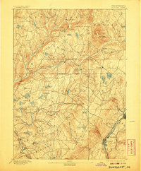
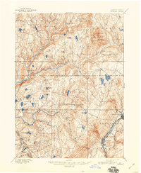
1892 Map of Dundaff
USGS Topo · Published 1907About this map
The northern reaches of the Lackawanna Valley and the surrounding plateaus are dominated by the industrial activity concentrated along the Delaware & Hudson Canal Co. RR. While the valley floor around Carbondale, Jermyn, and Mayfield reflects the density of coal-era transport and urban development, the western and northern portions of the quadrangle remain defined by a more dispersed agricultural and lake-district character. Significant high points like North Knob and Elk Hill overlook a landscape carved by the Tunkhannock Creek and its many branches.
Find a feature on this map
81 named features on this map. Tap any name to fly to it.
Don’t see what you’re looking for? This feature index may not catch every label — zoom into the map to look around manually.
Map Details
Editions of this 1892 Dundaff Map
6 editions found
Other maps of this area

1889 · Scranton
USGS Topo · 1:62,500

1891 · Scranton
USGS Topo · 1:62,500

1892 · Honesdale
USGS Topo · 1:62,500

1892 · Dundaff
USGS Topo · 1:62,500

1893 · Pittston
USGS Topo · 1:62,500

1893 · Scranton
USGS Topo · 1:62,500

1926 · Starrucca
USGS Topo · 1:62,500

1928 · Ariel
USGS Topo · 1:62,500

1930 · Starrucca
USGS Topo · 1:48,000

1932 · Ariel
USGS Topo · 1:62,500