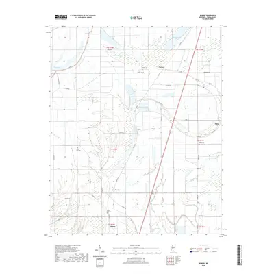
2020 Map of Dundee
USGS Topo · Published 2020About this map
Dundee sits at the heart of this alluvial landscape in northwestern Mississippi, where the drainage patterns of Ark Bayou and Beaverdam Bayou shape the local geography. The area is defined by its deep agricultural ties and a network of rural roads such as Dundee Rd and Old Hwy 61 that connect small settlements like Maud, Clayton, and Hamlin. Historically significant family and community landmarks are scattered throughout the quadrangle, including numerous burial grounds like Mount Olive Cem, Mount Sinia Cem, and Rising Sun Cem. To the northwest, the large expanse of Flower Lake and various oxbow remnants like Withers Brake and Kyles Brake illustrate the shifting nature of the Delta's watercourses. This contemporary survey provides a clear view of the land divisions and named landmarks that continue to define Tunica County.
Find a feature on this map
52 named features on this map. Tap any name to fly to it.
Don’t see what you’re looking for? This feature index may not catch every label — zoom into the map to look around manually.
Map Details
Editions of this 2020 Dundee Map
This is the sole edition of this map. No revisions or reprints were ever made.
Other maps of this area

1908 · Lula
USGS Topo · 1:24,000

1908 · Dundee
USGS Topo · 1:24,000

1908 · Hollywood
USGS Topo · 1:24,000

1908 · Moon Lake
USGS Topo · 1:24,000

1908 · Walnut Lake
USGS Topo · 1:24,000

1910 · Dundee
USGS Topo · 1:31,680

1910 · Walnut Lake
USGS Topo · 1:31,680

1912 · Moon Lake
USGS Topo · 1:31,680

1912 · Lula
USGS Topo · 1:31,680

1913 · Hollywood
USGS Topo · 1:31,680