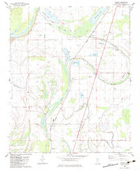
1982 Map of Dundee
USGS Topo · Published 1983About this map
Agricultural life in the Mississippi Delta during the early 1980s is defined here by the intricate relationship between the fertile floodplain and a network of oxbow lakes and bayous. The Illinois Central Gulf railroad serves as the primary spine for the region, connecting the rural communities of Dundee, Clayton, and Maud. The landscape is a maze of hydraulic features, from the natural arcs of Flower Lake and Cypress Lake to the protective levee and numerous fish farms that characterize the local economy.
Find a feature on this map
34 named features on this map. Tap any name to fly to it.
Don’t see what you’re looking for? This feature index may not catch every label — zoom into the map to look around manually.
Map Details
Editions of this 1982 Dundee Map
This is the sole edition of this map. No revisions or reprints were ever made.
Other maps of this area

1908 · Lula
USGS Topo · 1:24,000

1908 · Dundee
USGS Topo · 1:24,000

1908 · Hollywood
USGS Topo · 1:24,000

1908 · Moon Lake
USGS Topo · 1:24,000

1908 · Walnut Lake
USGS Topo · 1:24,000

1910 · Dundee
USGS Topo · 1:31,680

1910 · Walnut Lake
USGS Topo · 1:31,680

1912 · Moon Lake
USGS Topo · 1:31,680

1912 · Lula
USGS Topo · 1:31,680

1913 · Hollywood
USGS Topo · 1:31,680