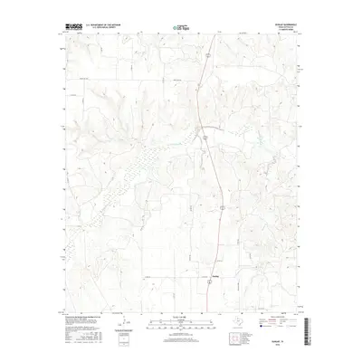
2016 Map of Dunlap
USGS Topo · Published 2016About this map
The Middle Pease River meanders across this Cottle County landscape, carving a wide bed through the high plains of North Texas. The settlement of Dunlap serves as a central point in an area defined by extensive ranching and county road networks, where the terrain is dissected by numerous drainage systems including Sweetwater Cr and Turkey Cr. The presence of Bluff Cr and Ox Cr highlights the complex hydrology required to sustain this semi-arid region. Transportation is facilitated by a grid of local routes like Ranch Rd 1440 and Ranch Rd 2998, which connect isolated homesteads and ranching operations to the larger region. This survey captures the rural character of the Texas Rolling Plains, illustrating how the natural watercourses dictate the placement of roads and small communities.
Find a feature on this map
21 named features on this map. Tap any name to fly to it.
Don’t see what you’re looking for? This feature index may not catch every label — zoom into the map to look around manually.
Map Details
Editions of this 2016 Dunlap Map
This is the sole edition of this map. No revisions or reprints were ever made.
Other maps of this area

1954 · Plainview
USGS Topo · 1:250,000

1958 · Plainview
USGS Topo · 1:250,000

1966 · Cee Vee
USGS Topo · 1:24,000

1966 · Devils Canyon
USGS Topo · 1:24,000

1967 · Buckle L Ranch
USGS Topo · 1:24,000

1967 · Tell South
USGS Topo · 1:24,000

1967 · Hell Roaring Creek
USGS Topo · 1:24,000

1967 · Dunlap
USGS Topo · 1:24,000

1967 · Paducah
USGS Topo · 1:24,000

1967 · Moons Camp
USGS Topo · 1:24,000