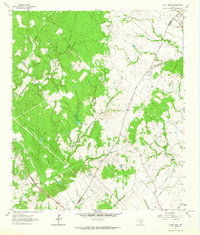
1963 Map of Dunn Creek
USGS Topo · Published 1964About this map
The historical Dunns Fort (Site) anchors the northern reach of this landscape, marking a legacy of early frontier settlement along the headwaters of Dunn Creek. By the early 1960s, the terrain shows a mixture of wooded creek bottoms and open agricultural land, defined by the winding paths of Campbells Creek and Thompson Creek. The rural social fabric is visible through scattered institutions like Friendship Ch and Mt Zion Ch, while the Walker Settlement Cem and Henry Cem offer vital clues for genealogists tracking local families. The Southern Pacific railroad cuts through the southwestern corner, reflecting the vital transportation artery that served the small community of Alexander and the surrounding area. Numerous Gravel Pits suggest active local industry during this period, set against a network of rural routes including Rabbit Lane and Tabor Road.
Find a feature on this map
29 named features on this map. Tap any name to fly to it.
Don’t see what you’re looking for? This feature index may not catch every label — zoom into the map to look around manually.
Map Details
Editions of this 1963 Dunn Creek Map
2 editions found
Other maps of this area

1954 · Austin
USGS Topo · 1:250,000

1956 · Bryan
USGS Topo · 1:62,500

1956 · Caldwell
USGS Topo · 1:62,500

1961 · Mumford
USGS Topo · 1:24,000

1961 · Hearne North
USGS Topo · 1:24,000

1961 · Hearne South
USGS Topo · 1:24,000

1962 · Edge
USGS Topo · 1:24,000

1962 · Wheelock
USGS Topo · 1:24,000

1962 · Bryan East
USGS Topo · 1:24,000
1962 · Bryan West
USGS Topo · 1:24,000