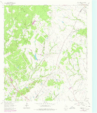
1963 Map of Dunn Creek
USGS Topo · Published 1980About this map
Dunn Fort marks the northern reaches of this landscape along the Robertson and Brazos County line, where a network of rural roads and rail lines defined local life in the mid-20th century. The Southern Pacific railroad cuts through the southwestern corner, paralleling Campbells Creek, while family and community landmarks are scattered across the interior. Significant genealogical sites include the Walker Settlement Cem and Henry Cem, alongside local congregations at Friendship Ch and Mt Zion Ch. The drainage patterns of Spring Creek and Dunn Creek indicate a region shaped by small-scale agriculture and transit, with numerous Gravel Pits suggesting localized industrial activity. Many of the primary routes, such as Rabbit Lane and Broach Road, provide a look at the settlement patterns that existed before late-century development altered the character of the Texas countryside.
Find a feature on this map
24 named features on this map. Tap any name to fly to it.
Don’t see what you’re looking for? This feature index may not catch every label — zoom into the map to look around manually.
Map Details
Editions of this 1963 Dunn Creek Map
2 editions found
Other maps of this area

1954 · Austin
USGS Topo · 1:250,000

1956 · Bryan
USGS Topo · 1:62,500

1956 · Caldwell
USGS Topo · 1:62,500

1961 · Mumford
USGS Topo · 1:24,000

1961 · Hearne North
USGS Topo · 1:24,000

1961 · Hearne South
USGS Topo · 1:24,000

1962 · Edge
USGS Topo · 1:24,000

1962 · Wheelock
USGS Topo · 1:24,000

1962 · Bryan East
USGS Topo · 1:24,000
1962 · Bryan West
USGS Topo · 1:24,000