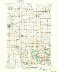
1922 Map of Durand
USGS Topo · Published 1950About this map
Durand stands as a significant railroad hub in the early twentieth century, where the Grand Trunk line intersects with several others, shaping the growth of western Genesee and Shiawassee counties. This survey, conducted just after the First World War, captures the rural landscape before the expansion of the modern highway system, showing a dense network of country schools such as the Irish School, Crocker School, and Chaffee School.
Find a feature on this map
122 named features on this map. Tap any name to fly to it.
Don’t see what you’re looking for? This feature index may not catch every label — zoom into the map to look around manually.
Map Details
Editions of this 1922 Durand Map
4 editions found

Other maps of this area

1907 · Howell
USGS Topo · 1:62,500

1908 · Fowlerville
USGS Topo · 1:62,500

1909 · Howell
USGS Topo · 1:62,500

1909 · Milford
USGS Topo · 1:62,500

1910 · Fowlerville
USGS Topo · 1:62,500

1917 · Chesaning
USGS Topo · 1:62,500

1919 · Burt
USGS Topo · 1:62,500

1920 · Flint
USGS Topo · 1:62,500

1920 · Holly
USGS Topo · 1:62,500

1921 · Burt
USGS Topo · 1:62,500