
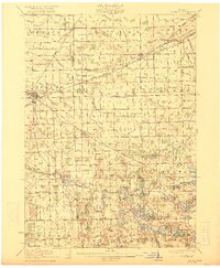
1922 Map of Durand
USGS Topo · Published 1922About this map
The railroad hub of Durand serves as a focal point for this early 20th-century survey of the Shiawassee and Genesee County borderlands. The intricate rail networks of the Grand Trunk and Ann Arbor lines converge here, illustrating the town's importance as a regional transportation nexus. Beyond the industrial tracks, the landscape is defined by its agricultural character, evidenced by the large Crapo Farm and numerous rural institutions such as the Unity Grange and Dye Church.
Find a feature on this map
107 named features on this map. Tap any name to fly to it.
Don’t see what you’re looking for? This feature index may not catch every label — zoom into the map to look around manually.
Map Details
Editions of this 1922 Durand Map
4 editions found
Other maps of this area

1907 · Howell
USGS Topo · 1:62,500

1908 · Fowlerville
USGS Topo · 1:62,500

1909 · Howell
USGS Topo · 1:62,500

1909 · Milford
USGS Topo · 1:62,500

1910 · Fowlerville
USGS Topo · 1:62,500

1917 · Chesaning
USGS Topo · 1:62,500

1919 · Burt
USGS Topo · 1:62,500

1920 · Flint
USGS Topo · 1:62,500

1920 · Holly
USGS Topo · 1:62,500

1921 · Burt
USGS Topo · 1:62,500