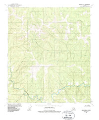
1956 Map of Eagle B-2
USGS Topo · Published 1988About this map
The North Fork Fortymile River dominates the southern reaches of this interior landscape, carving a deep, winding path through the high country of eastern Alaska. This mid-century survey, based on 1950s aerial photography, documents a terrain defined by its water drainage patterns rather than human settlement. Numerous tributaries such as Columbia Creek, Alder Creek, and King Creek feed into the broader watershed, illustrating the complex hydrology of the region before significant modern development. The absence of roads or established trails on this sheet highlights the isolation of the North Fork Fortymile River corridor. Toward the southwest, Hilda Creek and Wilson Creek mark the lower elevations where the landscape begins to transition into the river valley. For researchers of the Fortymile Mining District, the map provides a clear view of the natural landmarks and drainage basins that dictated early prospecting routes and territorial navigation.
Find a feature on this map
6 named features on this map. Tap any name to fly to it.
Don’t see what you’re looking for? This feature index may not catch every label — zoom into the map to look around manually.
Map Details
Editions of this 1956 Eagle B-2 Map
3 editions found
Other maps of this area

1899 · Fortymile
USGS Topo · 1:250,000

1951 · Eagle
USGS Topo · 1:250,000

1956 · Eagle C-1
USGS Topo · 1:63,360

1956 · Eagle C-2
USGS Topo · 1:63,360

1956 · Eagle A-1
USGS Topo · 1:63,360

1956 · Eagle B-2
USGS Topo · 1:63,360

1956 · Eagle A-2
USGS Topo · 1:63,360

1956 · Eagle B-1
USGS Topo · 1:63,360

1956 · Eagle B-3
USGS Topo · 1:63,360

1956 · Eagle C-3
USGS Topo · 1:63,360