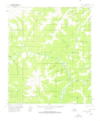
1956 Map of Eagle C-3
USGS Topo · Published 1980About this map
The North Fork Fortymile River carves through this remote interior landscape, creating a drainage network defined by remarkably named seasonal watercourses. Settlements are sparse, represented by an isolated Cabin and the high point at Happy. This mid-century survey reveals a territory largely untouched by infrastructure, where the primary landmarks are the winding creeks named during earlier prospecting eras. Distinctive labels like Merry Christmas Creek, New Year Creek, and Little Bonanza Cr suggest a history of exploration and discovery along the river’s tributaries. The topography is dominated by these intricate creek systems, including Independence Creek and Cassiar Creek, illustrating the complex watershed of the Fortymile mining district before significant modern development altered the region.
Find a feature on this map
17 named features on this map. Tap any name to fly to it.
Don’t see what you’re looking for? This feature index may not catch every label — zoom into the map to look around manually.
Map Details
Editions of this 1956 Eagle C-3 Map
2 editions found
Other maps of this area

1899 · Fortymile
USGS Topo · 1:250,000

1951 · Eagle
USGS Topo · 1:250,000

1956 · Eagle D-2
USGS Topo · 1:63,360

1956 · Eagle C-2
USGS Topo · 1:63,360

1956 · Eagle B-2
USGS Topo · 1:63,360

1956 · Eagle D-3
USGS Topo · 1:63,360

1956 · Eagle B-3
USGS Topo · 1:63,360

1956 · Eagle B-4
USGS Topo · 1:63,360

1956 · Eagle C-3
USGS Topo · 1:63,360
1956 · Eagle D-4
USGS Topo · 1:63,360