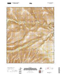
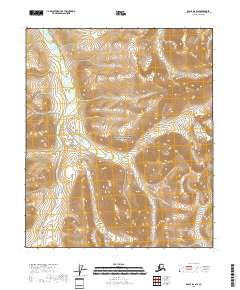
2018 Map of Eagle D-6 NE
USGS Topo · Published 2018About this map
Yukon-Charley Rivers National Preserve encompasses the entirety of this interior Alaska landscape, where the Charley River flows through deep drainage systems toward the north. The area is defined by significant elevation changes, with ridges and high plateaus surrounding the narrow valley of Crescent Creek (also labeled Crescent Cr) in the northwest. This 2018 survey reveals an almost entirely roadless wilderness, providing a detailed record of the natural topography and hydrologic patterns before any modern human encroachment. The lack of settlements or structures highlights the remote character of this protected drainage, making it an essential reference for understanding the geography of the Yukon-Koyukuk region.
Find a feature on this map
8 named features on this map. Tap any name to fly to it.
Don’t see what you’re looking for? This feature index may not catch every label — zoom into the map to look around manually.
Map Details
Editions of this 2018 Eagle D-6 NE Map
This is the sole edition of this map. No revisions or reprints were ever made.
Other maps of this area

1951 · Charley River
USGS Topo · 1:250,000

1951 · Eagle
USGS Topo · 1:250,000

1956 · Charley River A-5
USGS Topo · 1:63,360

1956 · Charley River A-6
USGS Topo · 1:63,360

1956 · Charley River
USGS Topo · 1:250,000
1956 · Eagle D-5
USGS Topo · 1:63,360
1956 · Eagle D-6
USGS Topo · 1:63,360

1957 · Eagle
USGS Topo · 1:250,000
2018 · Eagle D-5 SW
USGS Topo · 1:25,000
2018 · Eagle D-6 SW
USGS Topo · 1:25,000