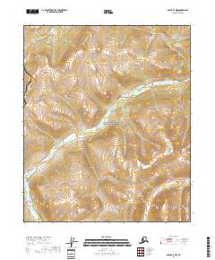
2018 Map of Eagle D-6 NW
USGS Topo · Published 2018About this map
Yukon-Charley Rivers National Preserve dominates this section of the Alaskas interior, where the high-latitude drainage systems of the subarctic landscape are meticulously documented. The terrain is defined by the winding course of Crescent Creek, also labeled as Crescent Cr, which carves through the undulating topography of the Eagle D-6 NW quadrangle. This 2018 survey provides a clear view of the complex hydrography and elevation changes within the protected preserve, reflecting the state of this remote wilderness in the early 21st century. The map is a critical reference for understanding the physical geography of the Yukon-Charley Rivers National Preserve, showing the exact relationship between the local watersheds and the regional township and range boundaries.
Find a feature on this map
9 named features on this map. Tap any name to fly to it.
Don’t see what you’re looking for? This feature index may not catch every label — zoom into the map to look around manually.
Map Details
Editions of this 2018 Eagle D-6 NW Map
This is the sole edition of this map. No revisions or reprints were ever made.
Other maps of this area

1950 · Big Delta
USGS Topo · 1:250,000

1951 · Big Delta
USGS Topo · 1:250,000

1951 · Charley River
USGS Topo · 1:250,000

1951 · Eagle
USGS Topo · 1:250,000

1951 · Circle
USGS Topo · 1:250,000

1955 · Circle A-1
USGS Topo · 1:63,360

1955 · Circle
USGS Topo · 1:250,000

1956 · Charley River A-6
USGS Topo · 1:63,360

1956 · Charley River
USGS Topo · 1:250,000
1956 · Eagle D-6
USGS Topo · 1:63,360