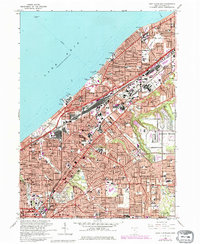
1963 Map of East Cleveland
USGS Topo · Published 1980About this map
Lake Erie defines the northern edge of this densely populated Cuyahoga County corridor during a period of significant post-war urban expansion. The massive Collinwood Yard and the rail lines of the Conrail and Norfolk and Western systems dominate the industrial landscape, serving as a vital transportation spine between Cleveland and Euclid. Residential neighborhoods are anchored by a high density of parish schools and institutions, such as St Josephs High Sch and Notre Dame College, reflecting the area's deep-rooted community character.
Find a feature on this map
59 named features on this map. Tap any name to fly to it.
Don’t see what you’re looking for? This feature index may not catch every label — zoom into the map to look around manually.
Map Details
Editions of this 1963 East Cleveland Map
3 editions found
Other maps of this area

1901 · Euclid
USGS Topo · 1:62,500

1903 · Cleveland
USGS Topo · 1:62,500

1903 · Euclid
USGS Topo · 1:62,500

1905 · Mentor
USGS Topo · 1:62,500

1906 · Chagrin Falls
USGS Topo · 1:62,500

1907 · Mentor
USGS Topo · 1:62,500

1908 · Chagrin Falls
USGS Topo · 1:62,500

1950 · Cleveland
USGS Topo · 1:250,000

1953 · Chagrin Falls
USGS Topo · 1:24,000

1953 · Shaker Heights
USGS Topo · 1:24,000